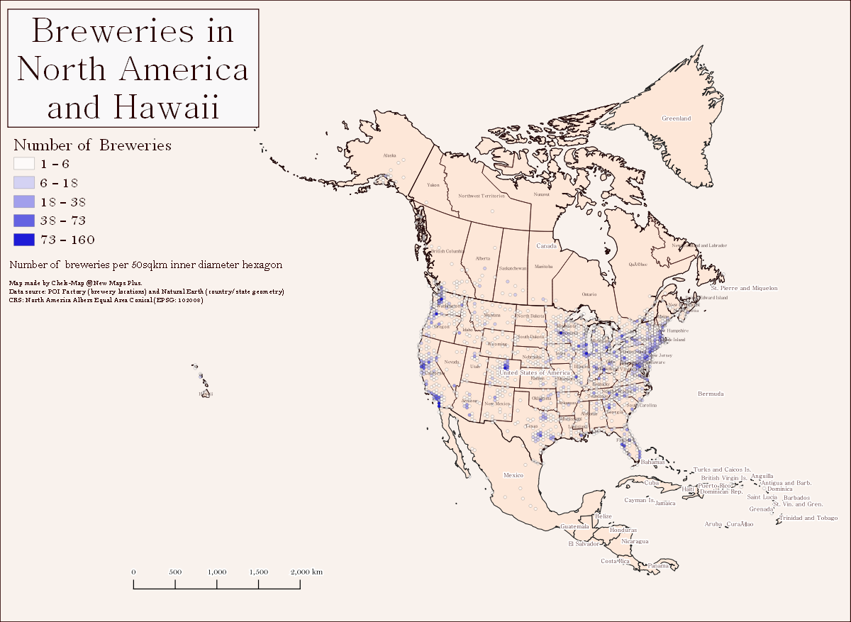
Boozy Brews
This map was created with QGIS 3.14 and Windows 10 using data from the POI Factory and the Natural Earth. CRS: North America Albers Equal Area Conic (EPSG:102008)
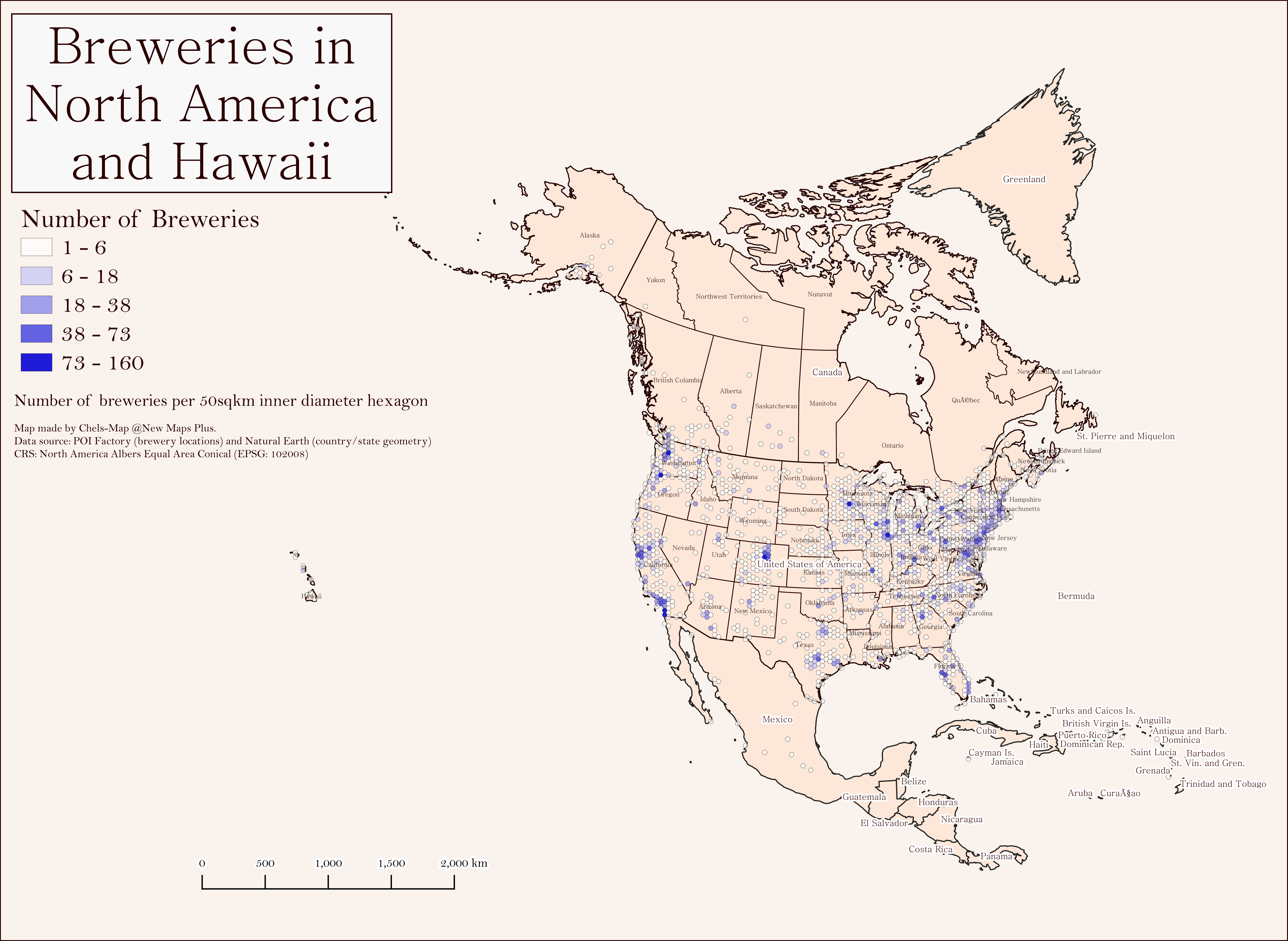
Summer Sunshine: Photoperiod in Kentucky
An interpolation of daylight length across Kentucky county boundaries for the month of June. Photoperiod data is from Dr. Garrett Owen at the University of Kentucky.
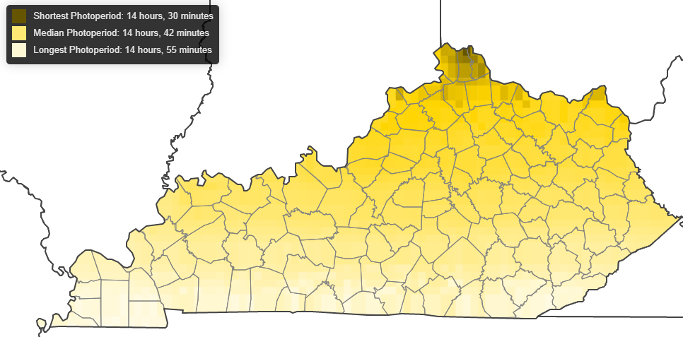
Farming around Capitol Hill
Urban Agriculture in Washington, D.C., with data from the D.C. Department of Energy and Environment
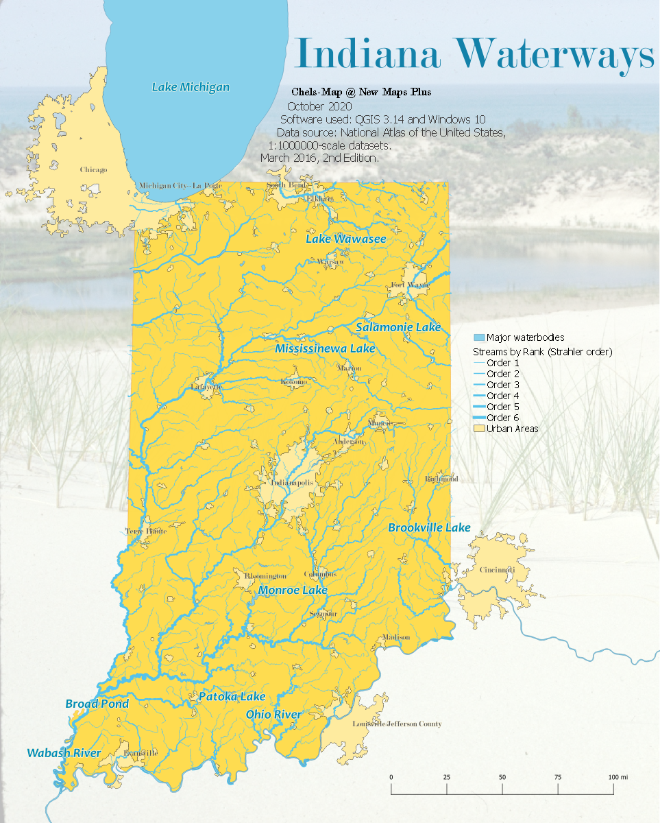
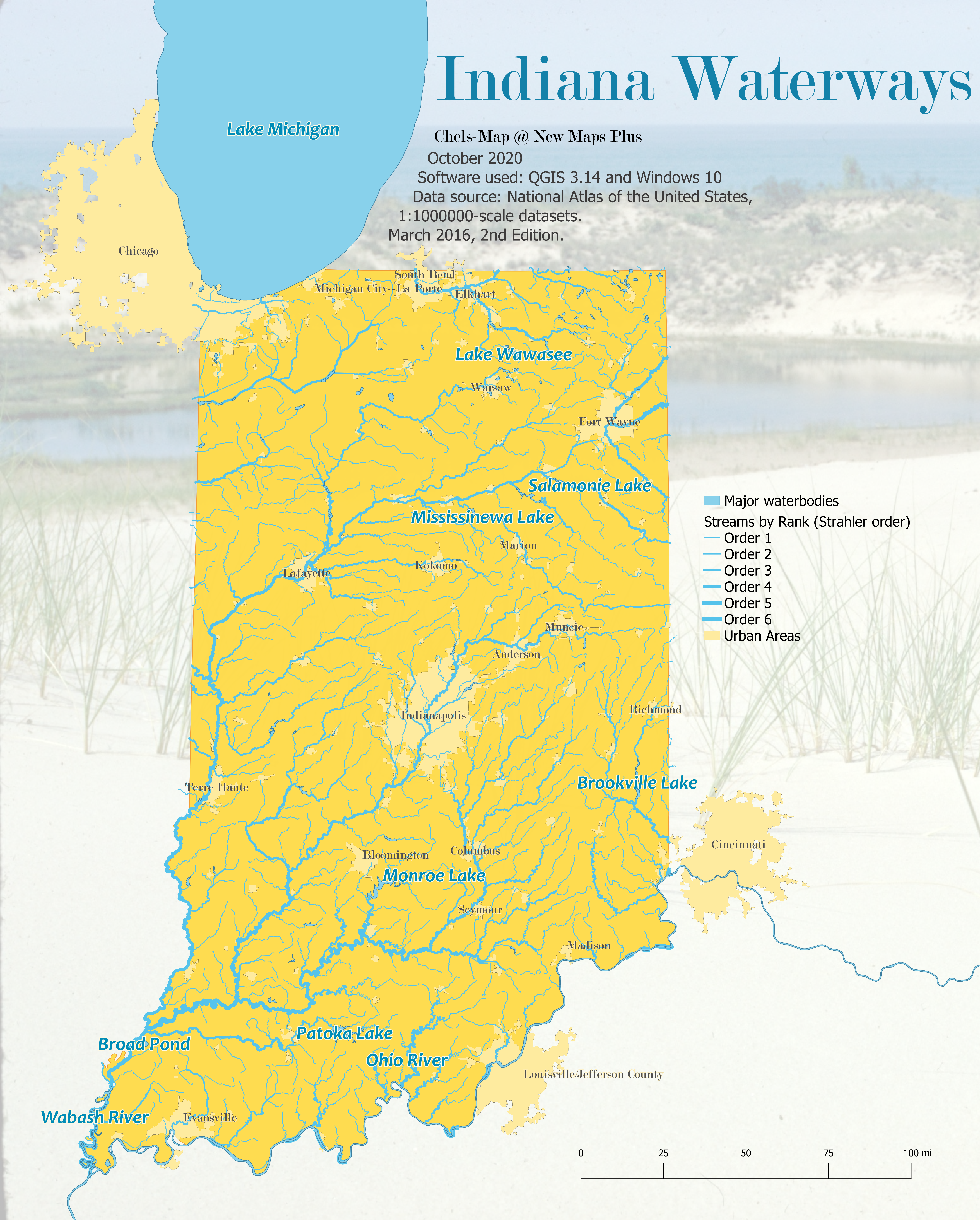
Go with the Flow
This map of waterways in Indiana was created with QGIS 3.14 and Windows 10 using data from the National Atlas of the United States, 1:1000000-scale datasets from The National Map Small-Scale website. March 2016, 2nd Edition.